Markus Jonsson
@auonsson
22,787
Followers
435
Following
2,954
Media
11,697
Statuses
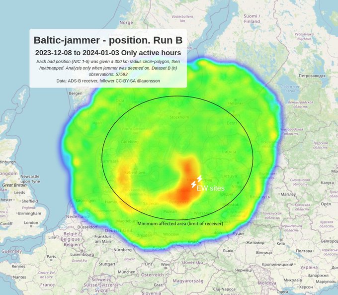
Pseudonymous osint. Every system is a sensor if you hold it right. Trying to limit myself to Baltics. backup 🇸🇪
Joined January 2022
Don't wanna be here?
Send us removal request.