
Bernie Rayno
@AccuRayno
38,089
Followers
2,455
Following
2,352
Media
37,898
Statuses
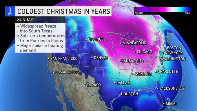
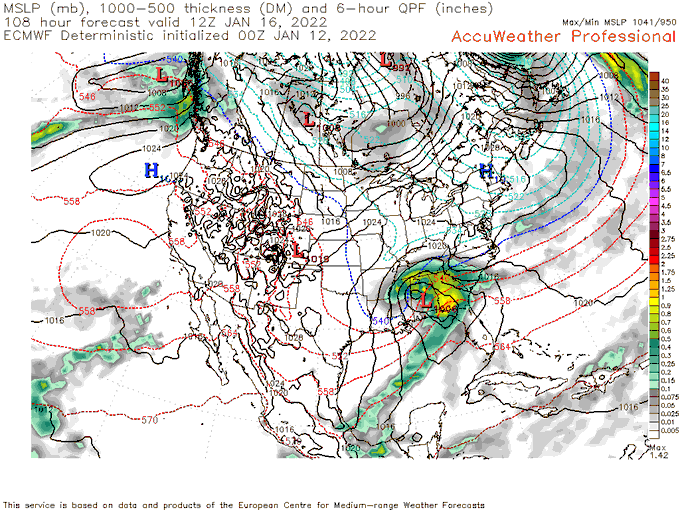
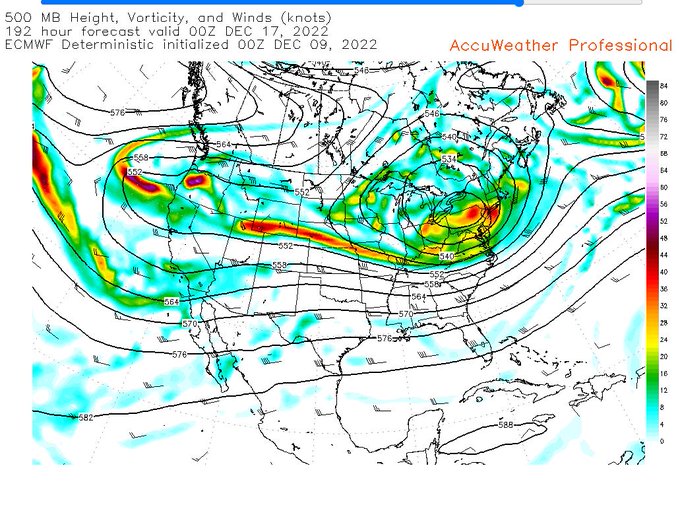
Chief Video Meteorologist for @AccuWeather -Penn State Meteorology Proud (1990)-Eat,Sleep & breathe Green Bay Packers.Views expressed here are my own
Don't wanna be here?
Send us removal request.