Stormwx1 Profile Banner
Stormwx1 Profile
Stormwx1

@stormwx1

6,446
Followers
698
Following
8,772
Media
27,040
Statuses

⚡️⛈️

Joined December 2016
Don't wanna be here? Send us removal request.
@stormwx1
Stormwx1
3 years
Binghamton via Snapmaps, just incredible stuff and still coming down at 4-6” per hour. #nywx
80
491
2K
@stormwx1
Stormwx1
4 years
Woah, huge wedge #tornado near Seven Oaks, TX via Snapmaps. Same tornado that went Onalaska. #txwx
30
461
1K
@stormwx1
Stormwx1
8 months
First ever Auroras, Grand Valley, ON 📍 (sorry for the spam) #northernlights
Tweet media one
4
25
218
@stormwx1
Stormwx1
4 years
This is extreme close-range of the Seven Oaks, TX wedge via Snapmaps. My goodness. #txwx
@stormwx1
Stormwx1
4 years
Woah, huge wedge #tornado near Seven Oaks, TX via Snapmaps. Same tornado that went Onalaska. #txwx
30
461
1K
9
94
199
@stormwx1
Stormwx1
8 months
stop this. one of the best things i’ve ever seen. Grand Valley, ON 📍
Tweet media one
4
28
199
@stormwx1
Stormwx1
1 year
“One could certainly describe this storm system as a once in a generation type of event” per NWS BUF AFD.
Tweet media one
15
63
195
@stormwx1
Stormwx1
4 years
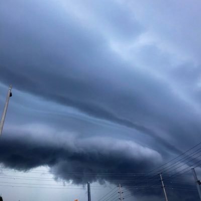
Incredible shelf cloud. South Mississauga 414 pm #onstorm
Tweet media one
8
20
165
@stormwx1
Stormwx1
3 months
It looks like there’s no end in sight for Cape Breton and eastern NS… this will be a lifetime memory for residents. Going to be impossible to get accurate measurements but looking at 100-150cm totals (up to 60 in) by later tomorrow.
8
35
166
@stormwx1
Stormwx1
5 years
#DVP right now: Entire highway snow covered, plows can’t operate due to significant traffic, vehicles are stalled or have spun out, people are walking on the highway and abandoning their vehicles, some tow truck drivers have abandoned their trucks, and snow continues. #onstorm
Tweet media one
Tweet media two
Tweet media three
11
129
157
@stormwx1
Stormwx1
2 years
This has to be one of the higher end wind events on record in S ON. Just unbelievable what’s unfolded this afternoon.
@adam_safaoui
Adam Safaoui
2 years
Trees being knocked down and cars being pushed over #ONstorm #ottnews @weathernetwork
174
1K
4K
8
31
143
@stormwx1
Stormwx1
10 months
Tornado impacting the Ottawa metro #onstorm
@couldstartacult
sel
10 months
tornados close to costco in barrhaven ottawa ontario ….
75
402
1K
6
45
123
@stormwx1
Stormwx1
5 years
@ezralevant This is such an awful comparison. Comparing mainly gang-related violence to a white nationalist terrorism crisis in the United States. 11 shootings, still bad but no deaths (no heavy assault weapons) compared to 2 shootings in the US with assault weaponry with 30+ deaths.
12
3
112
@stormwx1
Stormwx1
2 years
Historic winter storm highlights in the GTA: 1. First blizzard warning since the 90s in Toronto. 2. 55 cm in Oshawa, 52 cm in Whitby, and up to 46 cm in Toronto (YYZ 32 cm). 3. 12 cm/hr (!!!) snow rate recorded at downtown station. 4. DVP & Gardiner full closure + 401 disaster.
3
25
114
@stormwx1
Stormwx1
1 year
No more updates tonight from me. Unforgettable storm in regards to the widespread thundersnow and snowfall rates this afternoon. Hope my forecasts helped. Good night and drive safe tonight and tomorrow. 🤙
6
1
106
@stormwx1
Stormwx1
11 months
Tomorrow looks… awful.
Tweet media one
6
19
96
@stormwx1
Stormwx1
4 years
What looks to be a mixture of lightning and power flashes via Snapmaps in Chattanooga, TN as a strong #tornado just impacted the eastern suburbs prompting a tornado emergency nearly an hour ago. #tnwx
8
32
89
@stormwx1
Stormwx1
8 months
omg
Tweet media one
0
5
91
@stormwx1
Stormwx1
1 year
That was fun.
Tweet media one
12
5
85
@stormwx1
Stormwx1
1 year
🤯 so much thundersnow this evening
Tweet media one
1
6
82
@stormwx1
Stormwx1
2 years
Wind gust to 121 km/h at Toronto YYZ!!! #onstorm
4
24
81
@stormwx1
Stormwx1
5 years
Just wanted to reveal some thing about myself... I am 17 years old. Yes, we all start somewhere lol. I am Interested in pursuing a degree in meteorology and I’d like to hear anything, preferably from current meteorologists, about universities to apply too/programs to take/etc.
14
0
79
@stormwx1
Stormwx1
2 years
This is either some very serious straight line winds (140+ km/h) or a tornado.
@Carrie_Chisholm
Carrie Chisholm
2 years
#Uxbridge hit hard by storm this afternoon. #thunderstorm
Tweet media one
Tweet media two
Tweet media three
Tweet media four
20
68
200
3
16
79
@stormwx1
Stormwx1
1 year
Insanity across the GTA.
Tweet media one
4
8
79
@stormwx1
Stormwx1
4 years
Tell me I’m wrong.
Tweet media one
4
7
75
@stormwx1
Stormwx1
2 years
Definitely a rare event. From Windsor-Sarnia and now approaching Ottawa. The widespread nature of 90+ km/h (and a couple reported 120+ km/h) gusts is not too common in S ON. Would classify as a derecho.
1
16
75
@stormwx1
Stormwx1
3 years
How could we be told to ‘lockdown’ and ‘stay at home’ when thousands of people are flying into and out of Toronto Pearson every single day. Has anyone seen the photos out of there? This is all so stupid.
8
8
75
@stormwx1
Stormwx1
1 year
Did you know… 6mm of ice accumulation adds up to 250 pounds of weight to power lines and tree branches. 12mm and that doubles to 500 pounds. Tomorrow’s ice storm could produce locally 20mm in SW ON. Heavy impacts on electrical infrastructure and trees.
4
13
76
@stormwx1
Stormwx1
4 months
One storm at a time but too hard not to talk about the Friday-Saturday storm. Potential for significant winter storm/blizzard with intense backside lake effect across S ON. Exact track will determine who sees the worst impacts— very strong winds a near certainty with this one.
Tweet media one
6
10
72
@stormwx1
Stormwx1
2 years
Exceptional concern for parts of Nova Scotia.
Tweet media one
Tweet media two
Tweet media three
2
23
73
@stormwx1
Stormwx1
5 months
This is quite the system.
Tweet media one
5
1
73
@stormwx1
Stormwx1
3 years
It does not feel like Christmas in two days. Anyone else feel the same? Feels like a regular week.
13
2
69
@stormwx1
Stormwx1
4 years
Some of the tornado damage in Monroe via Snapmaps. #lawx
2
45
64
@stormwx1
Stormwx1
2 years
Ottawa Hydro saying damage and impact to system is “significantly” worse than the 2018 tornado event and 1998 ice storm. That is saying A LOT.
6
14
66
@stormwx1
Stormwx1
4 years
Here are some more photos (first is a panoramic) of the elevated severe storm earlier near Bolton that was tracking toward downtown Toronto. #onstorm
Tweet media one
Tweet media two
Tweet media three
0
9
64
@stormwx1
Stormwx1
4 months
NWS forecasting close to 100cm in the Buffalo area by Tuesday
Tweet media one
6
17
67
@stormwx1
Stormwx1
5 years
Crazy cool experimental graphics just came in from @environmentca and the OSPC regarding Tuesday and Wednesday’s winter storm. #onstorm
Tweet media one
Tweet media two
Tweet media three
Tweet media four
8
41
65
@stormwx1
Stormwx1
5 years
Snapchat map video from Jefferson City, MO of extensive tornado damage. #mowx
5
45
55
@stormwx1
Stormwx1
2 years
GTA: Increasing confidence that second wave of winter storm misses just to the south. Will hold 6-12 cm for first wave and 2-5 cm for Thursday into Friday. Storm totals around 10-20 cm but leaning low. Higher totals Windsor-Niagara with 20-30 cm by Friday morning.
10
6
65
@stormwx1
Stormwx1
11 months
Cannot ask for more when trying to eliminate a heightened fire risk.
Tweet media one
4
9
65
@stormwx1
Stormwx1
4 months
No joke this is a NYS webcam on I-90.
Tweet media one
3
5
62
@stormwx1
Stormwx1
1 year
UPDATED TORONTO TIMELINE: 8-10 AM: Arctic front, rain changing to snow with flash freeze. 10-12 PM: Snow, possibly heavy, with winds gusting 50-80km/h. 1-3cm. 12-11 PM: Periods of snow or flurries with blizzard-like conditions at times. Winds gusting 80-100+km/h. 2-8cm.
4
16
60
@stormwx1
Stormwx1
1 year
Up to *120 cm* possible in the Buffalo metro by Saturday evening per latest NWS update. I expect snow squall watches for parts of Niagara sometime today or early tomorrow. Fort Erie, Crystal Beach, and parts of south Niagara should prepare for possibly prolific snowfall totals.
Tweet media one
2
16
62
@stormwx1
Stormwx1
5 years
1200 pm CDT: Explosive supercell development likely along the DL between 1-3PM CDT. 40-50 kt LLJ atop a warm sector characterized by >70F dewpoints and 4000-6000 J/kg surface-based CAPE. ESRH values 300-400+ m2/s2 across southwest OK/west TX. Violent tornadoes likely. #txwx #okwx
Tweet media one
Tweet media two
13
45
37
@stormwx1
Stormwx1
1 year
5 days out… big time storm signal. Some other guidance further south. Updates with this one after tomorrow’s system.
Tweet media one
11
5
60
@stormwx1
Stormwx1
2 years
Significant snow event becoming more likely for Toronto tomorrow night into Friday. Starting off as freezing rain/drizzle tomorrow afternoon with transition to heavy snow with peak snowfall rates 2-4+ cm/hr between 6 PM and 1 AM. Totals 15-20 cm, won’t rule out 25+ cm locally.
Tweet media one
2
16
59
@stormwx1
Stormwx1
1 year
Here we go folks… snow squall watches now in effect for multi-day lake effect event beginning tomorrow night through Sunday. Worst hit areas could see more than 60 cm by Sunday morning.
Tweet media one
4
11
61
@stormwx1
Stormwx1
2 years
24 hours later and the 401 is still a disaster in the west end.
Tweet media one
Tweet media two
Tweet media three
6
13
59
@stormwx1
Stormwx1
4 months
Not posting for exact #s but pretty clear that the Tuesday storm is going to produce a healthy swath of heavy snow (15-30+cm) *somewhere* across the Great Lakes/northeast US. Exact track and influence of Quebec high will determine who sees most ❄️.
6
10
57
@stormwx1
Stormwx1
2 years
Update for Toronto blizzard warning. Up to 60 cm now possible in parts of the GTA. Historic storm.
Tweet media one
5
13
60
@stormwx1
Stormwx1
1 year
Early look for late next week indicates this will be a problem for the interior northeast and much of the Great Lakes but it’s early… and things will change. But this is *high end* winter storm potential here folks during one of the busiest travel times of the year.
Tweet media one
9
9
59
@stormwx1
Stormwx1
2 years
Testing positive for COVID three days before Christmas. Sucks but oh well, lucky to be x2 vaxxed. Stay safe out there folks. Very mild symptoms for me (so far?).
10
0
59
@stormwx1
Stormwx1
1 year
Another weekend winter storm? Seems possible. Updates to come through the week.
Tweet media one
8
4
58
@stormwx1
Stormwx1
1 year
Here’s are the latest model outputs for snowfall (10:1) in Toronto: RAP: 30+cm HRRR: 30+cm HRDPS: 30+cm NAM: 20-30cm GFS: 20-30cm ECMWF: 25-35cm SREF mean: 23cm HREF: 20-25cm RDPS: 15-20cm Some bust potential with wetter snow or mixing but this is looking to be a big one.
11
10
57
@stormwx1
Stormwx1
2 months
This is just insane. SW flow ahead of the cold front is advecting smoke (well above the surface) from the fires in Texas and Oklahoma all the way into S ON this morning. Truly getting it all today in Ontario. @1Weathercanada pointed this out
Tweet media one
4
9
57
@stormwx1
Stormwx1
3 years
Storms should literally explode this afternoon. Very very unstable.
Tweet media one
6
9
55
@stormwx1
Stormwx1
2 years
Possibly one of the strongest worded winter weather related watch from Environment Canada for all of S MB and SE SK. “Do not plan to travel - this storm has the potential to be the worst blizzard in decades. Stock up on needed supplies and medications now…” Up to 80 cm locally.
Tweet media one
Tweet media two
Tweet media three
4
27
55
@stormwx1
Stormwx1
7 years
2
47
49
@stormwx1
Stormwx1
1 year
The wind event this weekend is not comparable to events we’ve seen recently. Winds will gust 70-110km/h for several hours across much of S ON. Numerous if not widespread power outages are possible with restoration hampered by extended strong winds, snow, and flash freeze effects.
6
11
55
@stormwx1
Stormwx1
1 year
Wednesday could be a big snow event for the GTA if current guidance holds. Easterly flow with tight temperature gradient will promote heavy snow including lake enhancement. Already seeing signals of 20+cm event for parts of the Golden Horseshoe. Still time for things to change…
Tweet media one
1
6
54
@stormwx1
Stormwx1
7 months
Incredible stretch of Fall weather coming up for the Great Lakes… both the GEFS and EPS ensembles are in good agreement of highly anomalous warmth for at least much of next week. Temperatures across S ON should be in the 26-30C range much of next week. ☀️
Tweet media one
Tweet media two
4
12
54
@stormwx1
Stormwx1
2 years
Not too often you see the NAM output snowfall amounts like this in our area with <30 hours from onset. Man oh man. 😅
Tweet media one
6
4
53
@stormwx1
Stormwx1
4 years
Snapmap video from London showing hail with the thunderstorms moving through the region. #onstorm
2
20
54
@stormwx1
Stormwx1
1 year
Don’t recall this amount of thundersnow in synoptic snow across S ON before. Windsor-Chatham area, London, Niagara, the GTA, and Kingston all seeing it today. First time I’ve ever heard it too!!!
Tweet media one
Tweet media two
8
12
53
@stormwx1
Stormwx1
4 months
Impressive
Tweet media one
6
6
53
@stormwx1
Stormwx1
1 year
Visualize my forecast: 15-20cm (20-25cm with limited mixing or ice pellets) near Lake Ontario but 20-30cm a handful of kilometres away from the Lakeshore. Locally up to 40cm possible in some areas across northern Halton and Peel. Majority of snow falls in 6 hours.
Tweet media one
13
7
53
@stormwx1
Stormwx1
4 months
Setup Friday night hasn’t changed much. You can see the dry slot and warmth pushing into S ON as system passes through Michigan. Area that gets both front end and wrap around snow (northwest quadrant) get highest amounts. Others get a few hour thump.
Tweet media one
7
3
51
@stormwx1
Stormwx1
1 year
If there was a worst case scenario for wind, it’s right here. My goodness.
Tweet media one
11
5
52
@stormwx1
Stormwx1
8 months
One thing I learned yesterday is that you don’t ‘chase’ no northern lights. You find a field and pray you see them. I’ve tried 3 times before and nothing. Last night was the first for me and I got incredibly luckily with the display I got.
5
1
51
@stormwx1
Stormwx1
1 year
Major winter storm appears to be likely for the GTA tomorrow evening into Saturday; preliminary forecast 10-20cm near Lake Ontario, 20-25+cm near 401/407. Near zero visibility at times with 70km/h wind gusts and snowfall rates 3-5cm/hr. Heavy wet snow = power outage potential.
2
4
49
@stormwx1
Stormwx1
2 years
An historic winter storm impacted S ON last night into today. Highest report from Whitby with 52 cm but much of the GTA saw 30-50 cm.
Tweet media one
6
9
50
@stormwx1
Stormwx1
1 year
I’m always hesitant in these setups but really looks like cold air is going to put up a fight aloft tonight. Last several HRRR runs showing 30+cm totals inching ever so close to Toronto. Be prepared for surprises with this one…
Tweet media one
4
1
50
@stormwx1
Stormwx1
5 months
Lots of talk about potential for a significant storm system this weekend into early next week… rightfully so. Still way too early for exact details on how the system evolves. Will update in the coming days…
Tweet media one
6
7
50
@stormwx1
Stormwx1
2 months
Impactful snowstorm possible for the GTA on Friday. Current guidance pointing to strong gradient near S ON which will promote heavy snow across the region. Conservative 5-10cm forecast but could be 10-20cm event with added lake enhancement off Lake Ontario.
Tweet media one
4
4
49
@stormwx1
Stormwx1
3 years
Likely going to have a pretty significant storm around the Great Lakes on Christmas Eve into Christmas Day. Tons of uncertainty obviously as we’re 6 days out but something to keep an eye on. “Everything is on the table” for southern ON. 😅
Tweet media one
7
3
49
@stormwx1
Stormwx1
4 months
Not an exaggeration saying this is going to be a 2-3 hour storm for the GTA south of the 401/407. Very intense snow band with ❄️⚡️ mid evening lasts a couple hours before mixing near Lake Ontario. A quick 4-8cm near Lake Ontario, 5-15cm 401/407, and 10-20cm N of 407.
Tweet media one
Tweet media two
Tweet media three
9
3
48
@stormwx1
Stormwx1
3 months
You’re kidding…
@Dylan_Hurleyh2
Dylan
3 months
Meanwhile, in Albert Bridge. #NSstorm
Tweet media one
44
371
1K
0
2
50
@stormwx1
Stormwx1
27 days
Wow
Tweet media one
Tweet media two
1
8
49
@stormwx1
Stormwx1
2 years
People should not have died from simply walking outside on Saturday. Every single death was preventable. People do not simply heed, care, or even receive warnings in this country and that is a big problem. Also, the EA system is still faulty as not everyone received the alert.
12
6
49
@stormwx1
Stormwx1
2 months
One hour temperature drops this morning… Kitchener: 13.6>0.6 London: 14.1>3.5 Hamilton: 14.6>5.6 Sudbury: 5.0>-9.5 Toronto: 15.6>5.9 (17 minutes)
1
8
48
@stormwx1
Stormwx1
11 months
Fires in Quebec will make for a very hazy day today but tomorrow into early next week look to be even worse. Some areas especially toward the Quebec border will have dense smoke near the surface.
1
22
47
@stormwx1
Stormwx1
2 years
“Houses torn apart… roofs torn apart…” per OPP north of Tweed. Major damage from that likely tornado. #onstorm @NTP_Reports
@PECsandbagger
County Comms
2 years
I don't usually tweet video of scanner comms but consider this a public service announcement I guess.
10
66
155
0
17
48
@stormwx1
Stormwx1
4 months
Good luck Bills fans! Intense lake effect with blizzard conditions likely Sat-Sun especially near and just south of downtown Buffalo. NWS forecasting more than 60cm by Mon AM around Buffalo.
Tweet media one
1
7
49
@stormwx1
Stormwx1
3 years
It’s coming and intensifying on its way.
Tweet media one
5
7
48
@stormwx1
Stormwx1
2 months
Toronto did not see one snowfall warning from Environment Canada this entire winter season. There was one (questionable) winter storm warning issued on Jan 12 but was only in effect for under a few hours. Not a very snowy 23-24 winter.
8
2
47
@stormwx1
Stormwx1
3 years
To me, nothing has changed at all today. Everything was just given a name. Stay at home order has no different meaning than what everyone’s been told to do for weeks now.
4
0
47
@stormwx1
Stormwx1
1 month
Can’t even imagine the GTA and Niagara traffic come April 7-8th. Going to be insane.
@burgwx
Tomer Burg
1 month
Some early concerns for eclipse day: There's a lot of unknowns, but *early* indications - which can still change *substantially* - slightly favor the Northeast US over the South Plains for the best eclipse viewing conditions, which could cause major travel issues. (1/2)
Tweet media one
5
13
141
12
6
48
@stormwx1
Stormwx1
4 years
Exeter is back. #onstorm
Tweet media one
4
5
47
@stormwx1
Stormwx1
4 months
Very intense snow band emerging and intensifying on approach to the GTHA over the next hour or two. Be prepared for rapidly deteriorating conditions. 530pm #onstorm
Tweet media one
Tweet media two
1
3
47
@stormwx1
Stormwx1
1 year
131cm at Buffalo Airport during this historic and deadly event. Peak wind gusts over 130km/h also occurred. An incredible event for a metro with over 300,000 people.
@wnywxguy
Josh Nichols
1 year
Updated storm total snowfall. #Buffalo #WNY #WX
Tweet media one
0
16
58
2
5
47
@stormwx1
Stormwx1
8 months
Had to get the power line shot
Tweet media one
3
4
46
@stormwx1
Stormwx1
3 months
Snow in February??? I know that seems like a novelty this year in Toronto but looks like 4-8cm coming up Thursday in the city (lower amounts with mixing) with up to 15cm for parts of cottage country and E ON.
Tweet media one
3
3
46
@stormwx1
Stormwx1
10 months
This is the 5th year in a row (since 2019) where S ON has had a significant severe weather event on either July 18, 19, or 20.
1
4
46
@stormwx1
Stormwx1
1 year
These are so unreal to look at… wowza.
Tweet media one
8
5
46
@stormwx1
Stormwx1
2 months
Lightning over the past 24 hours…
Tweet media one
0
6
47
@stormwx1
Stormwx1
3 years
Don’t know when that happened but that’s pretty sick to get a follow from TWN. 🤙
Tweet media one
2
0
46
@stormwx1
Stormwx1
8 months
😍
Tweet media one
2
0
47
@stormwx1
Stormwx1
2 years
Don’t see the ‘extreme’ impact contour that widespread on the WSSI too often.
Tweet media one
4
7
45
@stormwx1
Stormwx1
2 months
Feburary 28 in S ON… Temperatures in the mid to upper teens 🌡️ Wildfire smoke aloft 🔥 Thunderstorms with hail ⛈️ 10-15° temperature drops in under 30-60 minutes 🎢 Flash freeze 🧊 Snow squalls and blizzard-like conditions ❄️ 80km/h wind gusts and power outages💨 What else?
3
5
46
@stormwx1
Stormwx1
1 year
54cm in Orillia and close to 75cm in Washago with lake effect squall extending across parts of Bruce off Huron and east across Georgian Bay through Hwy 400 and 11… Environment Canada expecting another 40-70cm tonight locally.
Tweet media one
Tweet media two
1
5
45
@stormwx1
Stormwx1
4 months
Hi-res getting pretty enthusiastic here with locally 15+cm tomorrow around the GTA… think we’ll have statements or advisories from EC with this event but still not a very high confidence event.
Tweet media one
5
2
44