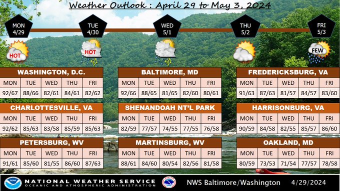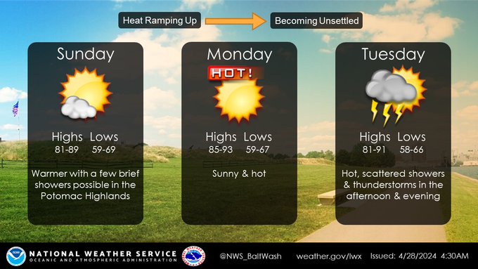
NWS Baltimore-Washington
@NWS_BaltWash
77,162
Followers
284
Following
16,119
Media
25,139
Statuses
Official Twitter Account for National Weather Service Baltimore/Washington. For NWS Posting Policy, click here:
Don't wanna be here?
Send us removal request.