
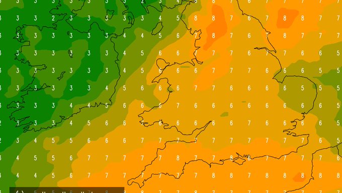
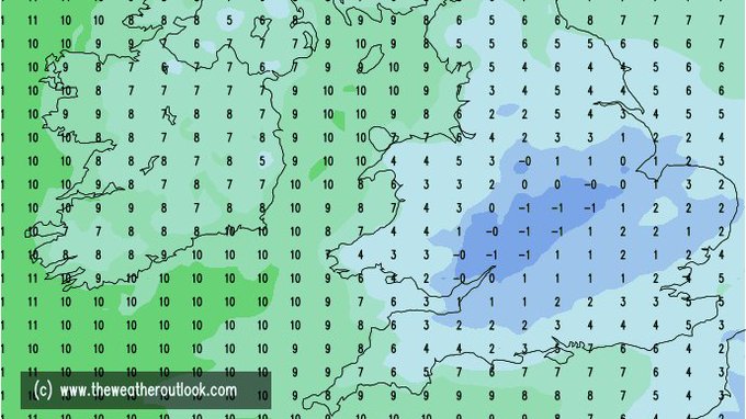
Beware charts showing 'airmass' temperatures next week. These (top chart) are for 5000 feet up, suggesting very mild air. But it looks likely that much chillier air (bottom chart) will stagnate near the ground from midweek, esp where
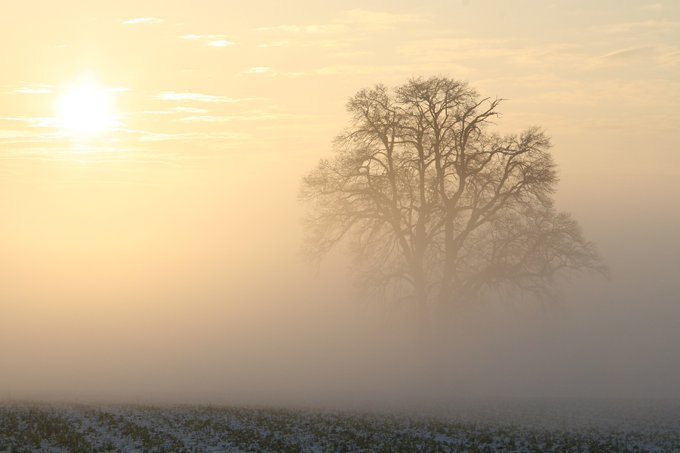
#freezingfog
lingers. Sub-zero maxes anyone?
5
14
78
Replies


@weathertrending
@MattHugo81
Shame no precipitation with those temps it would be snow or actually it wouldn't be snow because of mild air aloft?
1
0
0

@weathertrending
Afternoon John - I am a big fan of yours. I was wondering if you think there maybe a SSW this winter given we are in an easterly QBO? It will be ironic to think last winter we were in a westerly QBO yet still manage x2 SSW's. Do you think we could see any cold/snow this winter?
0
0
0

@weathertrending
@west_weather
I'm a big fan of frost, fog and freezing fog, hopefully less in the way of cloud like the December high
0
0
1