
Superb 3D GIS project mapping the fortified city of Livorno in Italy as it was in 1646 and combining this with a 1646 census of the population so that you can click on buildings and bring up a linked database entry on the occupants - clever stuff from
@DECIMAUoT
👍🏻
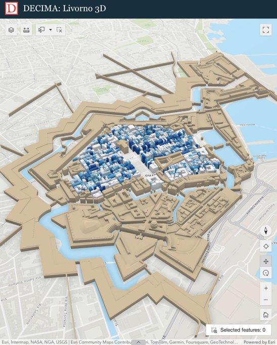
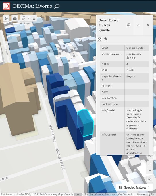

We have an exciting announcement here at DECIMA, the launch of Livorno3D - the newest stage in our digital mapping work!
1/6
1
15
42
1
68
270
Replies

@MarkWalters_
@DECIMAUoT
I am just learning, but is there any sort of centralized library of LIDAR for archaeology?
1
0
0
@smithjosephy
Do you mean a portal for lidar data that can be used in projects, or completed projects with processed and visualised lidar data ? In short, there isn’t really a good one-stop place for either yet on the web.
1
0
1