
Great to see that the Swedish
#lidar
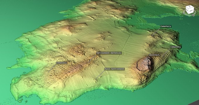
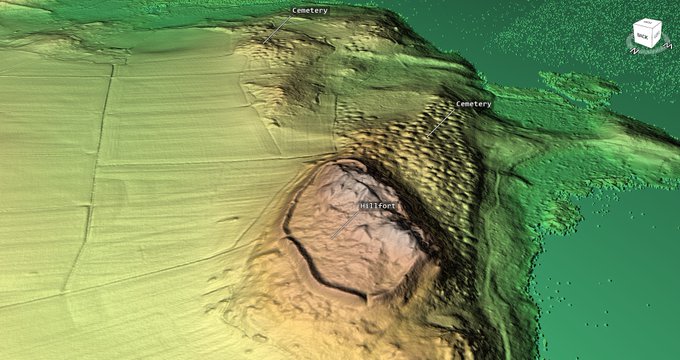
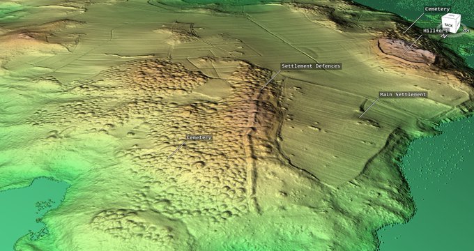
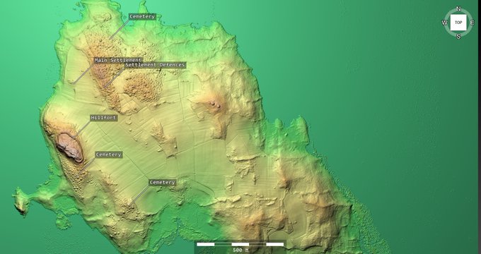
covering the Birka
#Viking
period settlement on Bjorko island, Lake Malaren is now available. Birka was an important trading settlement and port between c. 750 and 975 AD. There are around 3,000 graves in three main cemeteries.
6
24
133
Replies
If anyone wants to view the 3D model in their internet browser you can download the 57mb .html file here Double click the html file to open in your browser window and move around/zoom in with the mouse.

0
2
18

@larsTudor
Yes the lidar is open data. The portal for downloading is here You need to create a free account to download the files
1
0
4

@MarkWalters_
I chose not to think of how many thousand people I’ve guided amongst those burials… 🤣
Neat renditions! Brings a lot more sense into the landscape than the dull gray terrain model featured in e.g. the 🇸🇪 Historic Environment Record

1
0
8
@NyBjornG
Thanks 👍 Yes, I’ve been looking at the standard hillshade model for a few years now while waiting for the data to appear so that I could turn it 3D and have a closer view. It’s a superb site. Are there some tri-radial cairns in the cemeteries? I think I can see one large example
1
0
3


